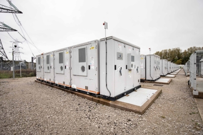


Hurricane, haze impact June’s solar production across Mexico, eastern U.S.
In a new weekly update for pv magazine, Solcast, a DNV company, reports that solar irradiance in June was impacted by Mexico's earliest major hurricane on record, while wildfire smoke and persistent cloud suppressed irradiance over most of central and eastern U.S.
In a new weekly update for pv magazine, Solcast, a DNV company, reports that solar irradiance in June was impacted by Mexico's earliest major hurricane on record, while wildfire smoke and persistent cloud suppressed irradiance over most of central and eastern U.S.
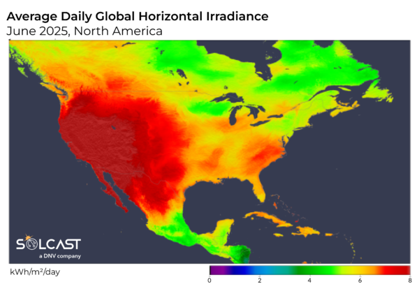
North America saw a turbulent start to summer, with major weather impacts on solar production across the continent. Mexico endured the earliest major hurricane on record, with cloud impacting irradiance significantly, while high pressure systems brought sunshine and dry conditions to the U.S. West. In the rest of the U.S., wildfire smoke and persistent cloud suppressed irradiance over most of the central and eastern regions. These trends defined a month of mixed solar performance, according to analysis using the Solcast API.
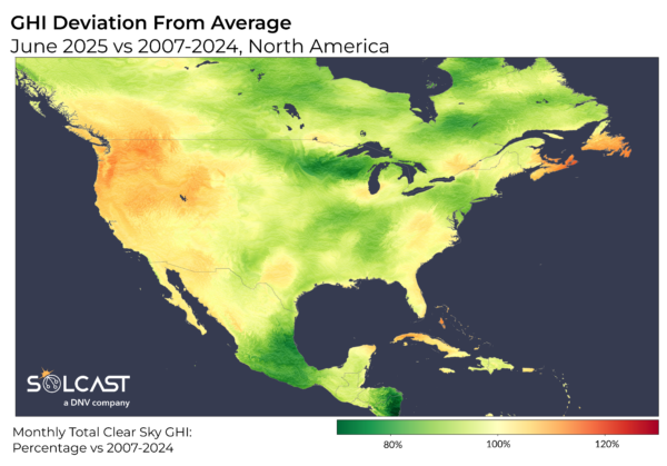
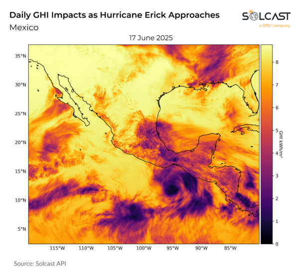
Hurricane Erick, which formed in mid-June, intensified into the season's first major hurricane and the first on record to hit Mexico before July. Despite being downgraded to a tropical depression upon landfall in the latter half of the month, Erick still delivered destructive winds up to 145 mph and torrential rains, causing landslides, infrastructure damage, and widespread power outages. The heavy cloud cover and storm conditions helped drive irradiance across central Mexico to dip by up to 30% compared to a typical June, a stark decline for a region usually favoured by early summer sunshine.
Meanwhile, the western half of the continent experienced markedly different conditions. While much of North America was exposed to aerosols from Canadian wildfires early in the month, prevailing westerly winds shielded the western U.S. and British Columbia from smoke-related solar losses. Combined with a persistent high-pressure system off the U.S. west and east coast, this brought dry air and clear skies, resulting in irradiance levels approximately 10% above the June norm. A similar effect was seen in far Eastern Canada, particularly in Nova Scotia and Newfoundland and Labrador, where cloud suppression led to above-average sunshine.
These high-pressure systems also drove broader climatic effects, contributing to dry spells across large parts of the U.S., where over a quarter of the country entered drought conditions. In the east, however, the story was different. While Canadian wildfires continued to generate aerosols, the eastern U.S. faced increased cloudiness that compounded the aerosol impacts. This combination led to irradiance deficits of up to 20% below June averages. By late June, Nova Scotia declared a heat wave, with daytime highs surpassing 30°C.
Solcast produces these figures by tracking clouds and aerosols at 1-2km resolution globally, using satellite data and proprietary AI/ML algorithms. This data is used to drive irradiance models, enabling Solcast to calculate irradiance at high resolution, with typical bias of less than 2%, and also cloud-tracking forecasts. This data is used by more than 350 companies managing over 300 GW of solar assets globally.
What's Your Reaction?